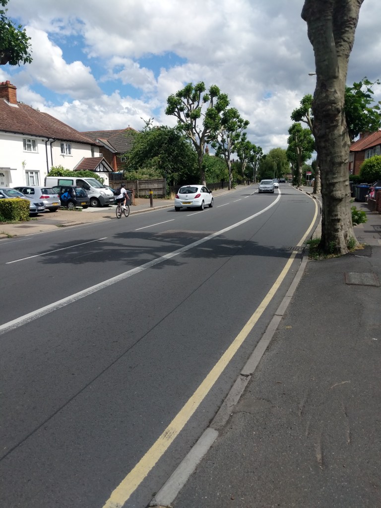
Construction of Cycleways on Ewell Road (Surbiton to Tolworth route) and Kingston Road (Kingston to New Malden route) have been making good progress in 2026! Since our last post at the end of 2025, a large section of the final Ewell Road section has been completed (from Red Lion Road to Worthington Road) featuring:
a new parallel crossing (for those walking and cycling);
an upgrade of a signalled pedestrian crossing to a toucan crossing (so now usable for those cycling too); and
the addition of around 400m of kerb separated cycle tracks in both directions.
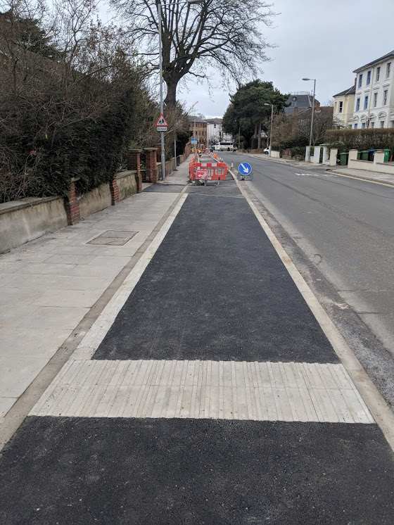
The works on Kingston Road are more complex and will continue through to early 2027 (construction phase details here). So far around 200m of kerb separated cycle track have been added in the Kingston direction and around 300m in the New Malden direction. Works continue to complete signage and ‘snagging’ on constructed sections with parking enforcement soon to take place to stop people parking their cars on the new Cycleway!
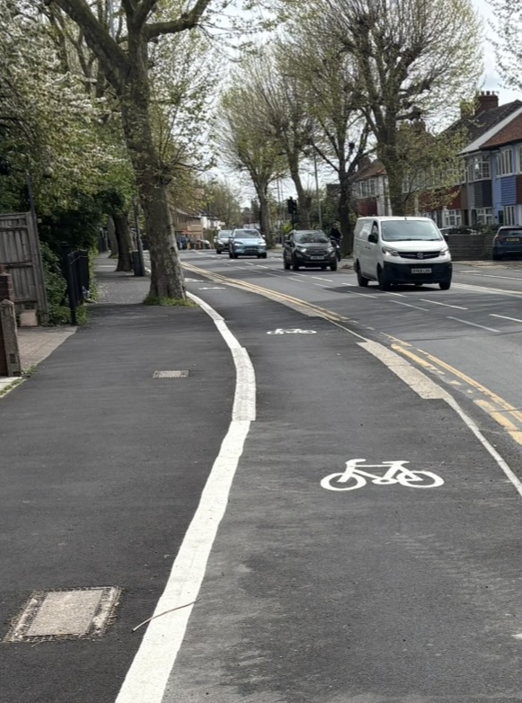
New separated cycle lane on Kingston Road
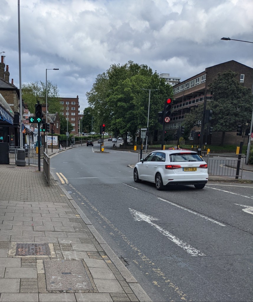
Works still to be undertaken on the Kingston to New Malden route include the junction of Cambridge Road and Hawk’s Road which is currently very difficult and unsafe for people on bikes to use. The changes to this junction will make it easier for people to cross on foot too.
Cambridge Road/Hawk’s Road junction – currently difficult and unsafe to navigate on bike but an upgrade is coming later this year!
We’re also working with the Council to improve sections already completed. If you have any feedback, please let us know!
What comes next?
Works on both schemes will continue for the rest of the year. On Ewell Road, this will include the upgrade of the junction with Elgar and Princes Avenues as well as the section around Kingsdowne/Ditton Road junctions (which should feature separate traffic signals for those cycling).
We continue to campaign for Cycleways to extend to other parts of the Borough. Help us by asking the next Council leader to commit to providing safe cycling routes elsewhere in the Borough – just click here and email them now!
Other links
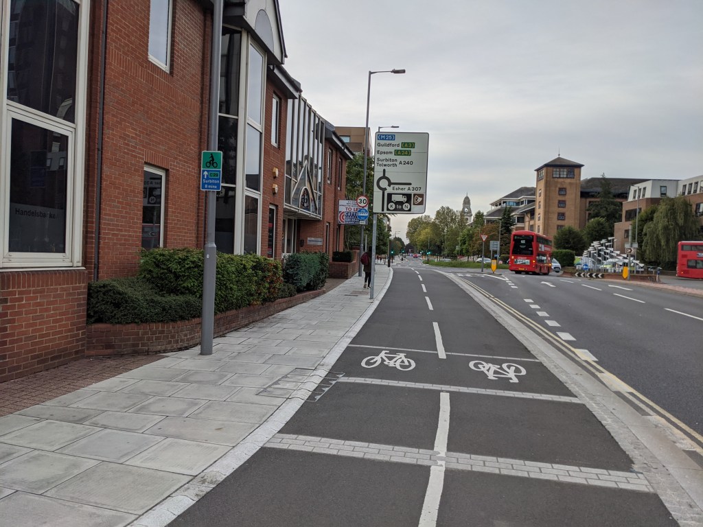
You can see a map of Kingston’s Cycleway network here.
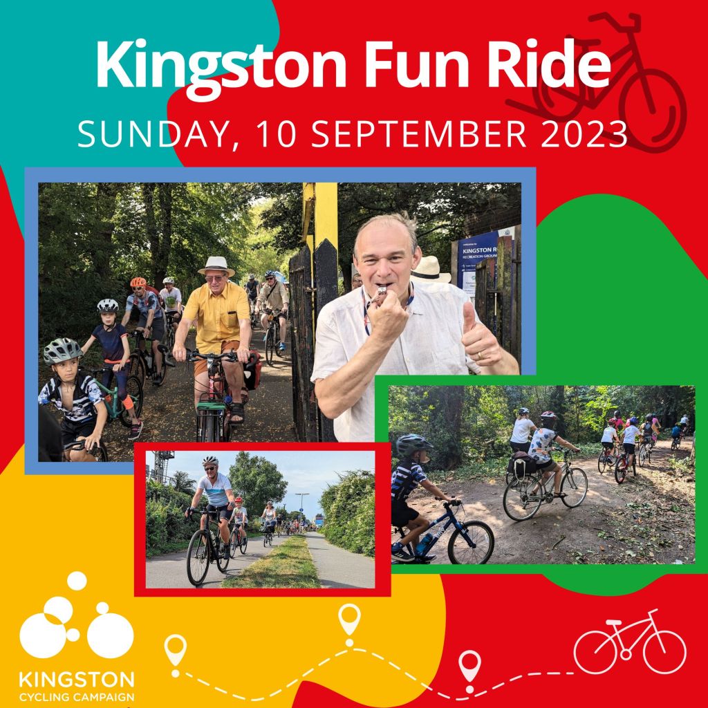
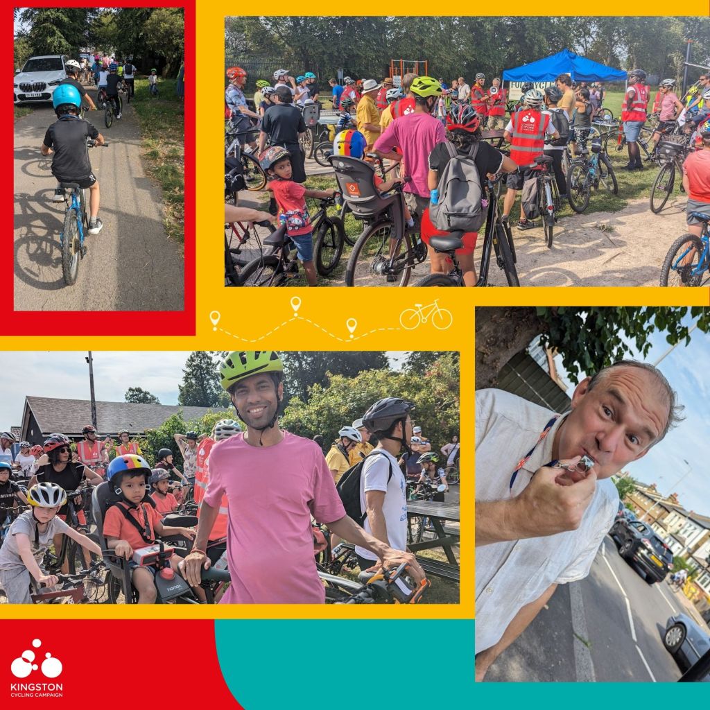
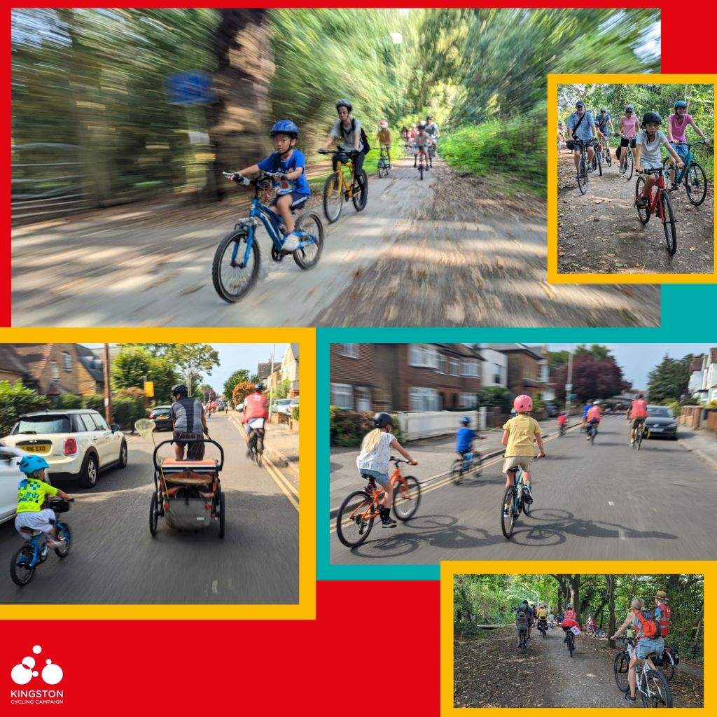
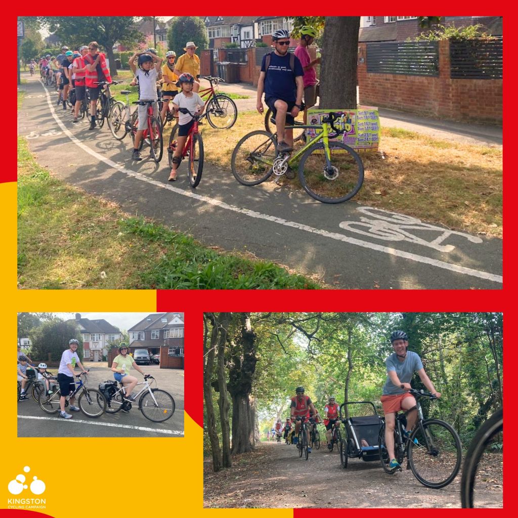
Blue skies and late summer sunshine provided a glorious backdrop for our second family-friendly, guided bike ride, which saw nearly 150 local residents gather in Kingston Road Recreation Ground on Sunday 10 September.
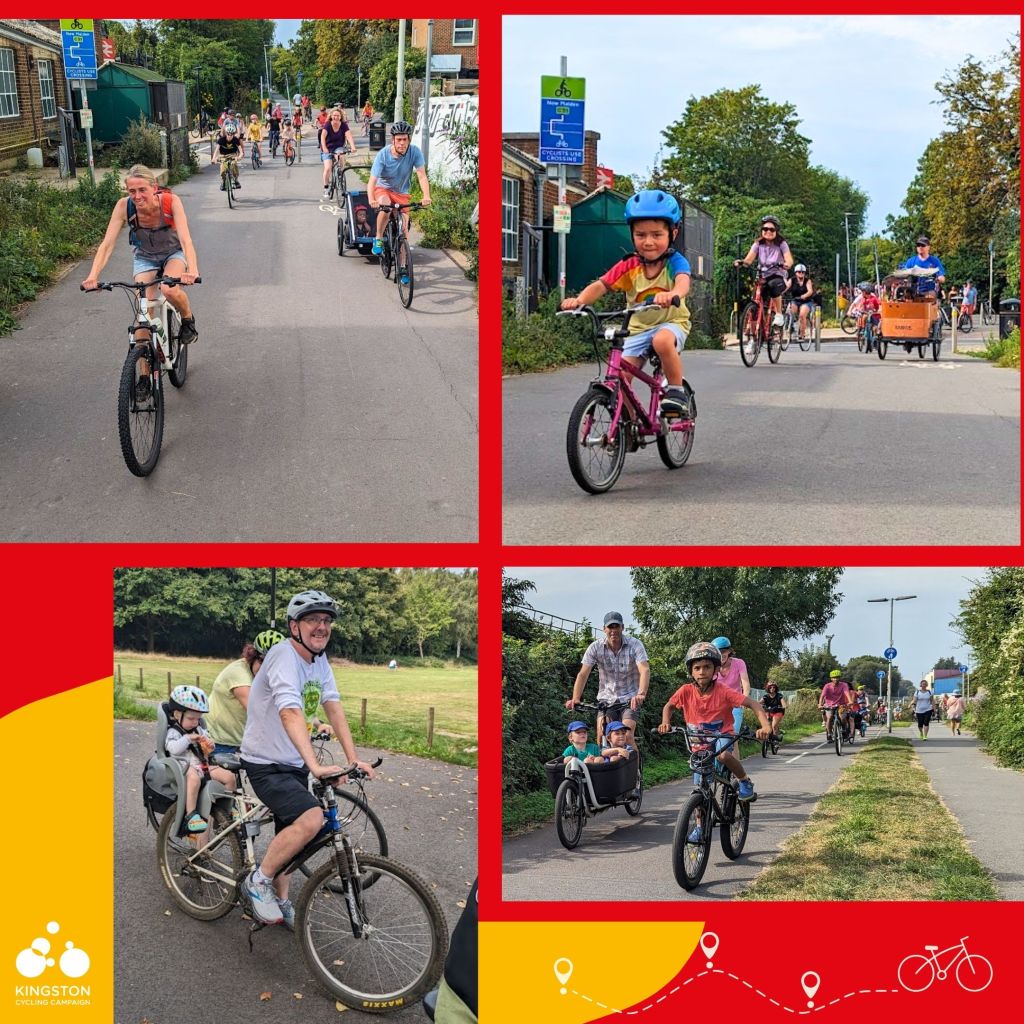
From sleeping toddlers to spritely grandparents, and cargo bikes to tandems, the smiling participants represented a fantastic cross-section of ages and experience levels, all united by a desire to build their cycling confidence.
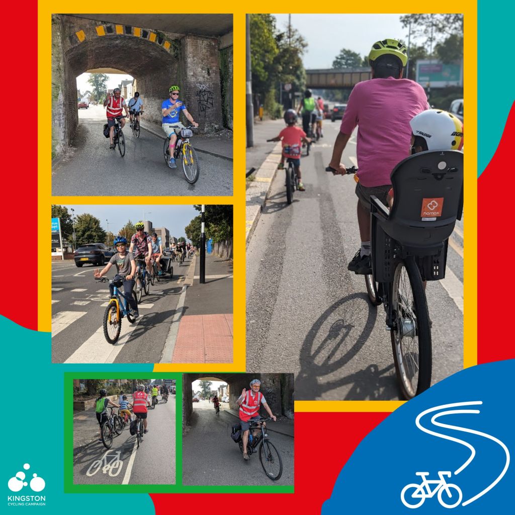
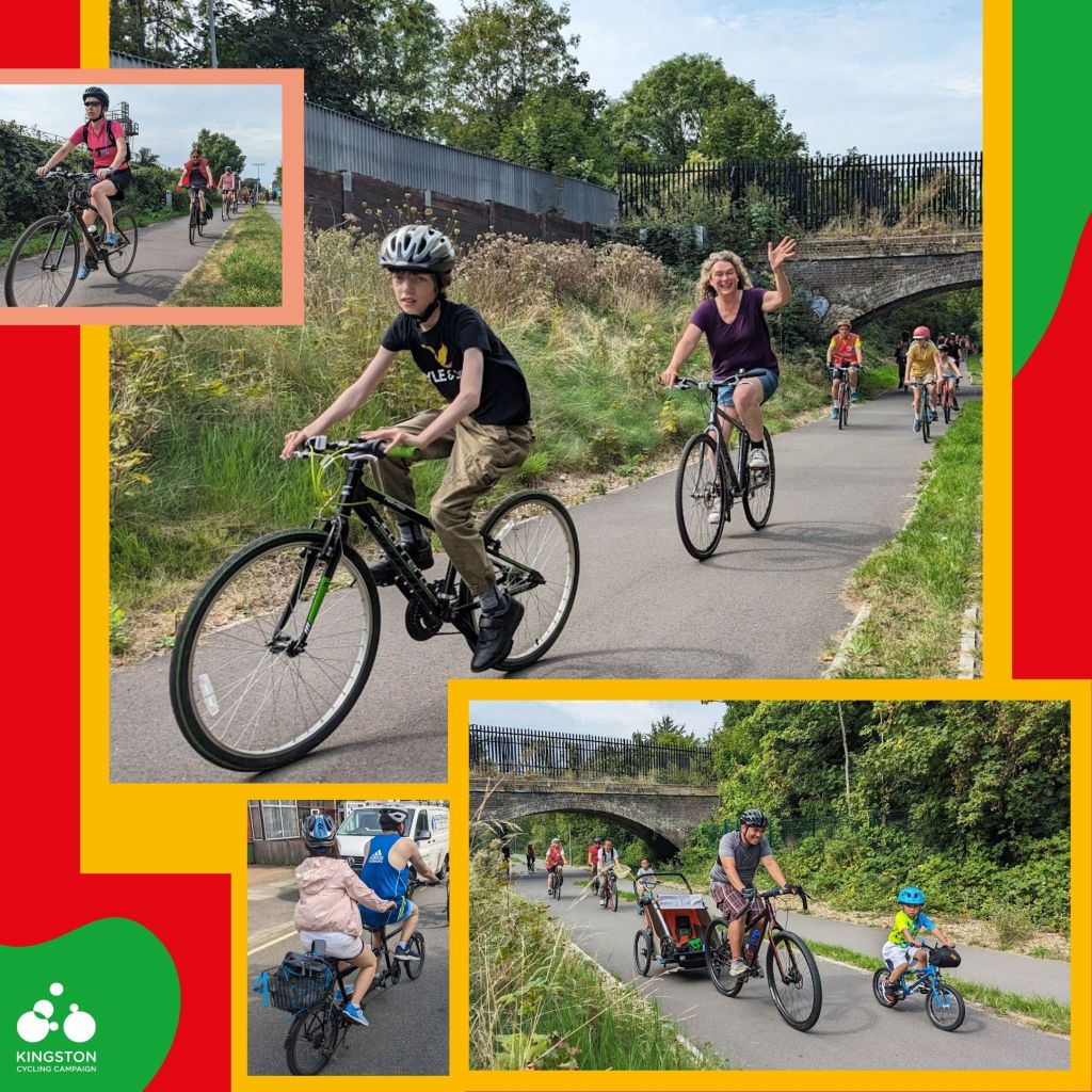
Adding extra excitement to the proceedings, local MP Ed Davey was on hand to meet the riders and cheer the group on after a whistle start. Our easy-paced 5.5 mile ride (route here) then took in a mix of the borough’s quieter roads, bike lanes and traffic-free routes, riding along the brilliant Beeline Way to Raynes Park, crossing back into New Malden via Malden Golf Course before weaving our way back to Norbiton.
“These rides are really fantastic at getting kids out with their mates – they help build their confidence so much.”
The gentle 5.5-mile circular route showcased a mix of quieter roads, bike lanes and low traffic neighbourhoods (LTNs), introducing many riders to fun new routes to explore the borough on two wheels.
“I’m relatively confident but being in a group makes such a difference and gives us the confidence to venture a bit further as a family.”
As with our June event, the outing represented the first group ride for many of those who joined in the fun, with the route helping introduce new corners of the borough to even some of the more experienced participants. What’s more, with such a wide range of non-standard bikes taking part, it demonstrated the importance of ensuring routes across Kingston are safe and accessible for all.
“I want to expose my young daughter to cycling, so being part of the ride was really enjoyable and positive for her.”
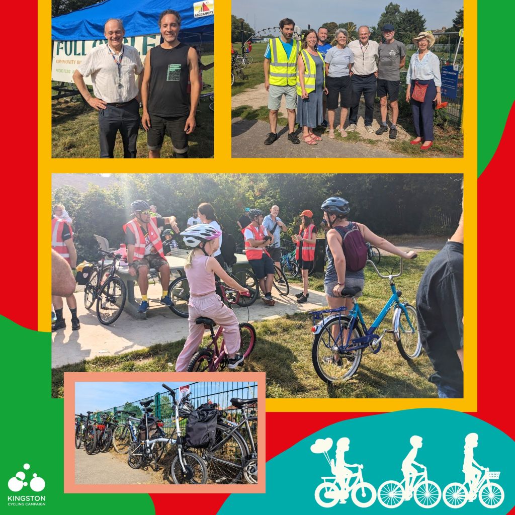
Thanks again to everyone – from ride assistants to participants – who helped make our scorchio September ride such a fun, family-friendly affair. And we’re especially grateful to our friends at Full Cycle Community Bike Project, Friends of Kingston Road Recreation Ground and the Friends of Beeline Way, who helped support us in the run-up to the big day and were all on hand to cheer us on.
Whether the event inspired you to join London Cycling Campaign (of which we’re the local group), come along on one of Kingston Cycling Campaign’s year-round calendar of longer rides for more experienced cyclists, or helped build your confidence to use two wheels for local journeys, we hope you enjoyed the ride.
Keep Sunday 14 January 2024 free to join our next family-friendly outing, starting from Alexandra Park in Berrylands. Sign up for your free place here.
Whilst the network of Kingston’s new Cycleways delivered as part of the Council’s ‘Go Cycle’ project is far from complete, it’s interesting to see the large number of people who are using the parts of the network already completed.
Although we see lots of people using the network on a daily basis, it is always interesting to have a look at real data to determine actual usage and look for any trends that can be spotted. We have therefore compiled some data from the Council’s existing Cycle Surveys as well as some more recent data produced from Vivacity traffic counting monitors which Kingston Council has been trialling and which we’ve received limited access to.
So, what does the data show us?
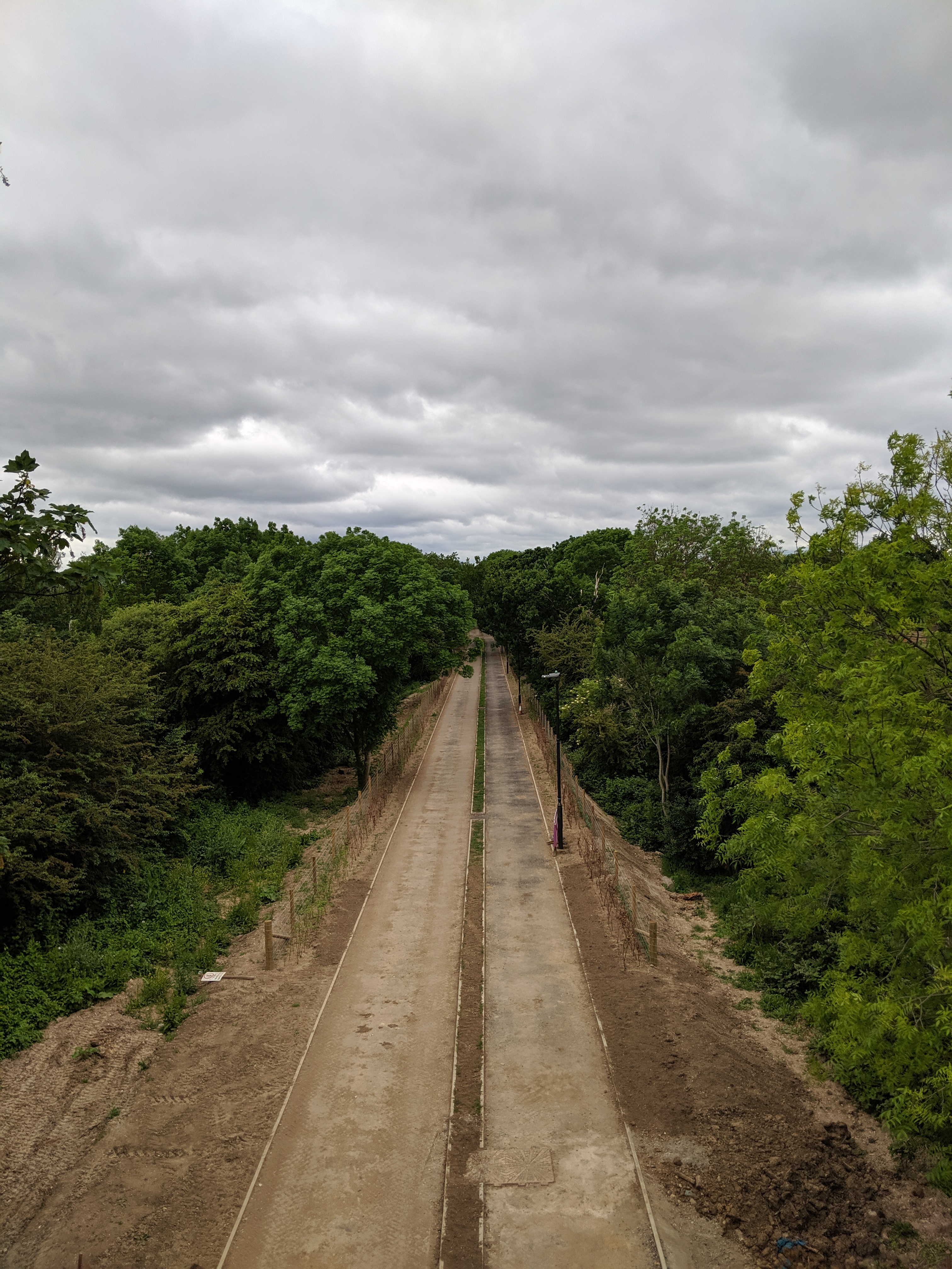
New Malden to Raynes Park (Cycleway 31)
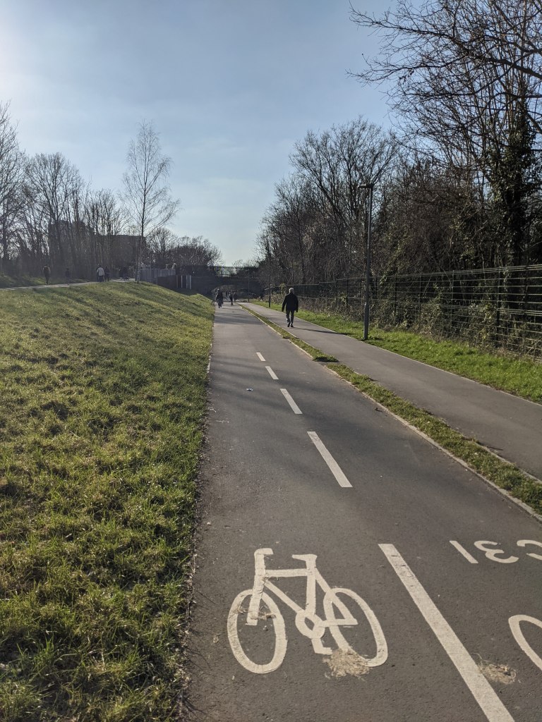
This excellent Go Cycle project created brand new walking and cycling paths alongside the South Western train mainline between New Malden station and Raynes Park recreation ground.
Kingston Council’s 2020 cycling survey stated that an average of 320 people were using this route for cycling each day. However, in 2021, The Vivacity sensor data trial shows that 542 people on average used it for cycling (between 14 May and 21 November 2021).
In addition to people using it for cycling, 703 trips by people walking have also been recorded on average each day. Given that before this route opened people couldn’t walk or cycle at all along this path, the data demonstrates how amazingly popular it has become in such a short amount of time.
The popular Beeline Way(Cycleway 31)
The popularity of the path is probably helped by it being away from roads meaning it has reduced air and noise pollution compared to alternative routes (for example, via Burlington Road).
Kingston to Kingston Vale (Cycleway 30)
This is the longest end to end Go Cycle project (4.5km) leading from the centre of Kingston to (almost) the Borough boundary with Wandsworth at the Robin Hood junction of the A3.
Despite construction being started in 2018, this Go Cycle route was only completed in full in early 2021 due to Covid related delays. However, parts of the route were open in 2020 and Kingston Council’s 2021 cycling survey stated the number of people using Kingston Hill for cycling was already increasing, with 363 people cycling on the route in 2020 compared to 211 in 2019 (noting that there had been a general increase in cycling in 2020 due to a national lockdown).
There isn’t a Vivacity sensor on Kingston Hill itself, but there is one on London Road near the end of the Go Cycle route by Tiffin School. This sensor shows an average of 1,521 cycling trips using the route a day (between 12 May and 21 November 2021). This compares with an average 15,467 cars being picked up by the sensor each day meaning, in the same year the route was completed, the number of cycle trips on this part of the route has already reached around 10% of the number of cars using the road!
The London Road section of the Kingston to Kingston Vale route (Cycleway 30)
Kingston to Surbiton (Cycleway 29)
This Cycleway was the second major road route to be completed as part of the Go Cycle programme (the first being Portsmouth Road). Unfortunately, this route suffers from many shared areas at junctions (where people cycling and walking mix in the same space), particularly along the Wheatfield Way part of the route. It therefore doesn’t provide direct, uninterrupted journeys for people cycling and its popularity as a cycling route is likely to be harmed as a result. Despite that, the Vivacity sensor on Wheatfield Way shows an average of 462 cycling trips on this part of the route per day (24 June to 21 November 2021) and 652 cycling trips on Penrhyn Road (6 May to 21 November 2021) based on a sensor near the Kingston University building.
A shared area section of Cycleway 29 at the junction of Wheatfield Way and Fairfield North
There is also a Cycleway ‘link’ route along Claremont Road towards Surbiton that connects to Cycleway 29 but isn’t the main Cycleway 29 route. The Claremont Road Cycleway is an indirect route as a decision was made to reroute the Cycleway around The Crescent rather than continuing it along the full length of Claremont Road (which would have required the removal of car parking spaces). The Vivacity sensor here recorded an average of 298 cycle trips per day (6 May to 21 November 2021).
The final Vivacity sensor we’ve seen data for on this route is on St Mark’s Hill though again, this is just a Cycleway ‘link’ and isn’t the main route for Cycleway 29. As with Claremont Road, due to the decision to keep car parking spaces, there is only a segregated cycle path on one side of the road (in the direction up the hill) reducing its popularity for people cycling. The Vivacity sensor here recorded an average of 359 cycle trips per day (6 May to 21 November 2021 (excluding 5 days in June where data recording appears to have failed)).
Surbiton to Kingston via Portsmouth Road (Cycleway 28)
This was the very first Go Cycle route to be built and was completed to a very high standard after Kingston Cycling Campaign successfully obtained improvements to the original plans.
This route features a two-way segregated cycle lane for most of its length and was extended in 2018 to take the two-way segregated cycle path along most of Kingston High Street (though unfortunately it does not yet reach the Ancient Market Place).
Sadly a Vivacity sensor has not been placed on this route so we need to look at data released as part of the Kingston Council Cycling Survey to look at numbers using this route. Helpfully, the 2021 survey provided average cycling figures for 2018-2020 (which we assume are from the automatic cycling counters the Council has installed on this road):
2018 – 1,068 people cycling per day
2019 – 1,114 people cycling per day
2020 – 1,582 people cycling per day
As the survey notes, during the middle part of 2020 there was a large increase in cycling following a national lockdown (the number of cycle trips peaked at 3,891 on a single day during 2020!) so it will be interesting to see if this has increase has been sustained on Portsmouth Road for 2021. In any case, it is great to see an increasing number of people using this safer cycle route.
Is there any other data available for this route? Well, the Department of Transport also compiles traffic counts and has one for Portsmouth Road. Looking at the Department of Transport’s figures we can see an actual (rather than estimated count) was last completed in 2016. Whilst this is a ‘spot count’ (it only counts people using the road on a single day rather than averaging it over a longer period), it shows that there were only 815 people counted cycling using the road on the day the count was taking place out of 15,424 total number of vehicles counted. Compared with that ‘spot day’ and the latest Kingston Council figures, cycling along the route has therefore almost doubled between 2016 and 2020.
As with the Kingston to Kingston Vale route, assuming the total number of vehicles using Portsmouth Road has remained broadly steady since 2016, the number of people cycling on the route could again be around 10% of the total vehicles using the road!
Portsmouth Road – Cycleway 28
Any other data?
Some other quick statistics:
1,370 walking or cycling trips on average per day across the new bridge taking people over the one-way system near Kingston Station (25 June to 21 November 2021 – Vivacity sensor data). Given this route was closed for over two years and only reopened earlier this year it’s already proving popular and allows for many more people to use it than the bridge it replaced.
421 cycling trips on average per day using the South Lane underpass to cross the A3. This is one of the few safe and convenient crossings of the A3 in this area (6 May to 21 November 2021 – Vivacity sensor data).
Only 394 cycling trips per day on average on Coombe Lane West (2 May to 21 November 2021 – Vivacity sensor data). This route was removed from the first phase of the Go Cycle programme and therefore lacks segregated cycling facilities. This is despite it being a major desire route for cycling between Norbiton and Raynes Park. It also passes a number of current (and planned) schools as well as Kingston Hospital. We hope that Kingston Council will be successful in their funding bid for Go Cycle phase 2 which provisionally includes this route. Coombe Lane West could then see an improvement in cycling rates as seen on the Go Cycle phase 1 routes already constructed.
More Department for Transport data suggests that, as mentioned earlier, there was a large increase in cycling nationally during the middle part of 2020 following a national lockdown. However, nationally, the data states that cycling levels in 2021 have broadly returned to those at the beginning of March 2020. The apparent increase in people cycling in Kingston during 2021 is therefore even more impressive.
What does all this data tell us?
It is important to emphasise that the Vivacity sensors are under trial and the figures used above have not been audited. However, the Vivacity sensors do seem to pick up a similar number of vehicles per day as shown in other recent Council traffic counts which use different technology. A trial of these sensors elsewhere in London also showed they were up to 97% accurate.
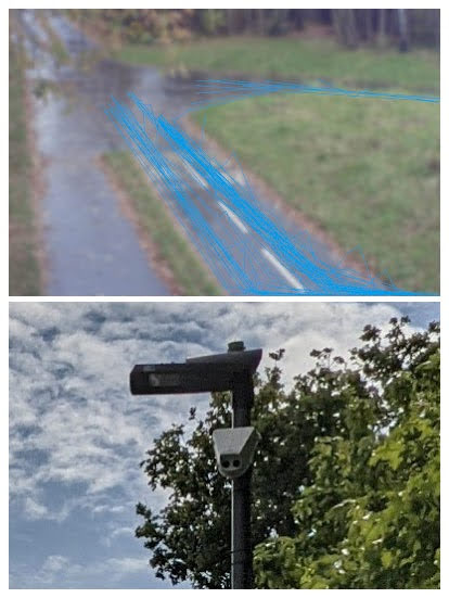
It is also interesting that the sensors can pick up ‘tracks’ of vehicles so can see what paths they are taking and which turns they make (see photo below). These images could help more easily determine the origin and destinations of journeys as well as helping understand whether people find the new cycling infrastructure useful or if they are avoiding it and are using the road instead.
Vivacity sensor image showing cycling ‘tracks’ along Beeline Way during a one hour period on 23 November 2021 and a picture of the sensor on a nearby lamppost
We look forward to hearing the results of the full trial of the Vivacity sensors and hope the Council will keep those in place on the Go Cycle network as well as filling in gaps in their coverage on the remainder of the network.
The data seems to show that the New Malden to Raynes Park has been very successful and also, that where there is continuous high-quality segregated cycle routes, e.g. Portsmouth Road and London Road, that cycling rates can be a substantial portion of the total number of vehicles using the route. However, where there are gaps in segregation for people cycling, for example Wheatfield Way, cycling rates seem to be lower. We therefore hope this data gives Kingston Council the drive to look at improving the continuity of exiting Cycle routes to provide direct and segregated routes, even through junctions.
Overall, the numbers of people cycling on the Go Cycle routes seem to be increasing. However, with Phase 1 of the Go Cycle network still not complete and Phase 2 currently unfunded, it will be some time before everyone in the Borough lives next to a safe cycling network. Until that happens, cycling levels in the Borough are unlikely to reach their full potential.
In our last update in May, we looked at the impact that Covid was having on Kingston Council’s plans to improve the Borough for cycling and walking. Since then, we’ve seen various Streetspace measures installed around the Borough as well as a restart to the construction of Kingston’s remaining Mini-Holland (or Go Cycle) programme.
This post provides an update on the progress of Kingston’s Mini-Holland programme since construction was paused in March this year due to Covid.
Firstly, why did construction stop?
When Covid lockdown measures were introduced, construction worksites across the country were paused and this included all those in Kingston’s Mini-Holland programme.
After construction was paused, Transport for London (TfL) got in touch with Kingston Council with some bad news….
TfL has been funding all of Kingston’s Mini-Holland programme and during the time that construction was paused, TfL realised that there was going to be a huge hit to its budget as people stopped taking journeys on its transport network. TfL therefore instructed all Boroughs to cease any remaining construction on TfL funded projects until further notice as they sought to save money.
Despite TfL’s request to pause projects, for some parts of Kingston’s Mini-Holland programme, contracts had already been signed with contractors and/or materials purchased with a number of worksites half finished. For these half finished sections, once safe social distancing measures had been implemented by contractors, construction continued to complete these stretches. This is why some limited construction on Mini-Holland projects happened in late Spring.
Following the pause in construction, the Government provided some emergency funding to TfL. TfL then awarded Kingston (along with some other London Boroughs) reduced funding to complete the remainder of the Mini-Holland projects that were already in construction:
Kingston to Kingston Vale (Kingston Hill and Kingston Vale)
Kingston Station hub and bridge
Surbiton to Tolworth (Ewell Road)
Unfortunately, as TfL only provided Kingston with reduced funding compared to the original budget agreed, the existing designs for the remaining stretches of the Mini-Holland schemes had to be revised to reduce costs. This meant that work couldn’t start on these stretches until new designs had been prepared; had new safety audits completed; and then received further TfL approvals. This is the main reason why some Mini-Holland schemes are still not completed.
Kingston to Kingston Vale
This scheme has been in construction for some time. However, since the start of this year, the 2-way cycle track along London Road between Queen Elizabeth Road and Manorgate roundabout was completed. The 1-way cycle tracks were also completed on each side of Kingston Hill between Manorgate roundabout and Queen’s Road.
London Road 2-way cycle track on the Kingston to Kingston Vale route
Apart from snagging (fixing small issues on sections now completed) the three remaining areas to complete the 4.5km Kingston to Kingston Vale route are:
Kingston Hill/Queen’s Road junction
Kingston Hill/Galsworthy Road junction
Section of one way cycle track between Robin Hood Lane and the A3
All the remaining sections of this route have been redesigned (to fit within the reduced budget) and are going through final approvals ready to be constructed. As the remaining sections involve two busy signalised junctions, we expect the Kingston Vale route will now not be complete until 2021. Once complete, the Council will need to ensure that this cycle route is adequately maintained as there are already regular accumulations of leaves and rubbish in the cycle lanes around the Kingston Vale part of the route as well as illegal parking on the new cycle track near Manorgate roundabout.
Surbiton to Tolworth
The first stretch of the Surbiton to Tolworth (between St Mark’s Hill and Brown’s Road) has recently reached practical completion with just snagging and a couple of crossings to finish this section. This stretch provides much needed segregation from cars, vans and lorries.
2-way cycle track on Ewell Road
The first section constructed features good continuous crossings over side roads (where people walking and cycling are given priority crossing roads to people in cars), has improvements to the bus ‘boarder’ design compared to the Kingston Vale route and includes new cycle parking.
As approved by the Council, unfortunately there are areas of shared use on this section (where people cycling have to share with people walking), particularly around the shops near Langley Road. This was done to keep car parking spaces which remains extremely disappointing and means some people cycling will prefer to use the main carriageway whilst others will find sharing with people walking very frustrating. We remain hopeful that this section will be revisted again one day to provide proper segregation.
Shared use area on Ewell Road
On the remainder of the Surbiton to Tolworth route (from Brown’s Road to Tolworth Broadway), this has had to be redesigned to fit in with the reduced budget provided by Transport for London. This redesigned section is currently going through the necessary approvals with TfL before construction can commence.
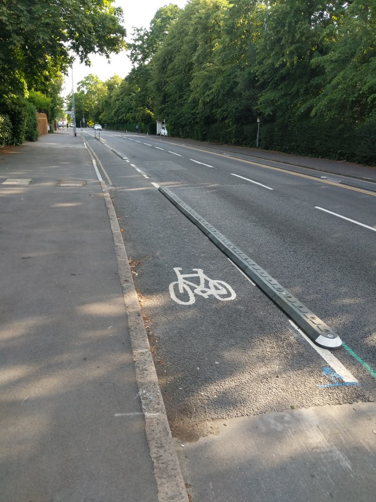
We understand that this resdesigned route will feature more ‘bolt down segregation kerbs’ vs stepped cycle tracks than originally planned. However, these bolt down segregation kerbs have worked well on the outer parts of the Kingston Vale route where they’ve already been installed. They have the clear advantage that they can be installed at a fraction of the cost of a stepped cycle track and can be added to the carriageway very quickly.
Cycle segregation kerbs installed on the Kingston Hill Cycleway
Kingston Station and hub
Again, more delays caused by funding being paused have held up completion of the widened pedestrian and cycle bridge over Kingsgate Road as well as fit out of the Kingston Station bike hub. However, the Kingston Station bike hub has had its plastic sheeting removed from the exterior and the installation of lighting, security measures and provision of a potential bike maintenance and cafe area has recommenced.
Once complete, the hub will allow the storage of hundreds of bikes and will include areas for cargo and non-standard bikes too (which are often larger and therefore cannot be secured easily to some of the cycle stands around Kingston currently).
Kingston Station bike storage hub being fitted out
Kingston to New Malden
This proposed cycle route was approved by Kingston Council at the beginning of the year. However, due to Covid, funding from TfL has been withdrawn and there’s currently no funding to complete this safe cycle route despite most of the design work having already been completed.
People cycling along the route (Cambridge and Kingston Roads) will therefore continue to be put at increased danger and many will continue to not even think about cycling along this route.
Whilst public transport options are reduced due to social distancing requirements and with climate change an increasing issue, prioritising improving conditions for cycling on these roads is even more important. We hope the Council can obtain funding for the improvements and we wonder whether contributions from property developments could be an alternative source of funds.
Kingston to New Malden route – very poor provision for people cycling currently
Anything else?
Improvements continue on completed Cycleways. Over the past few months, this has included:
Removing dangerous bollards from the middle of the 2-way cycle track on Portsmouth Road
Installation of green Cycleway signage on Wheatfield Way and in Surbiton
Improvements to loading bays on existing Cycleways to make enforcement of illegal parking easier
Spot the new green Cycleway sign on Wheatfield Way
Next steps
We’re looking forward to the schemes currently in construction being completed and hope that the remainder of the Ewell Road Cycleway will start construction soon.
We also want to see funding secured for the vital Kingston to New Malden Cycleway.
As always, if you have any comments or improvements you would like to see, let us know and we can pass them onto the Council. Follow us on Twitter for the latest updates too.
The New Malden to Raynes Park off-road cycling and walking route will be opening from 11am on Saturday 13 July 2019. Kingston Council will be holding a family fun day to celebrate the opening of the route.
More information on the opening can be found on the Council’s website.
Why not pop along and give it a try?
Background
The New Malden to Raynes Park route is a new off-road cycling and walking route being built as one of the Mini Holland (or ‘Go Cycle’) projects . These projects involve upgrading roads and routes across the Borough of Kingston to make it easier and safer to cycle and walk. Further information on the Mini Holland/Go Cycle projects can be found on the Council’s website.
The New Malden to Raynes Park link starts next to New Malden station (linking to the existing ‘Cut’ cycle and walking route to Elm Road) and continues parallel with the railway line and then past Raynes Park Recreation Ground to the existing cycle route on Coombe Lane (via Taunton Avenue and West Barnes Lane). It will also be possible to access the route from Alric and Dukes Avenue via a ramp.
Photo of the New Malden to Raynes Park cycle and pedestrian paths in construction (photo dated 26 May 2019)
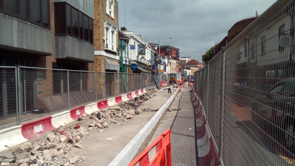
Progress continues on a large number of different Mini-Holland schemes in Kingston town centre. The main progress since our last update in June has been:
The Kingston High Street scheme has finished;
Works continue on Wheatfield Way;
The Kingston Station plaza is almost complete;
Work has commenced on the New Malden to Raynes Park scheme; and
Work has started on the main Kingston Vale route.
Kingston High Street – construction has now (subject to a couple of snagging points) been completed. This high quality scheme extends the very successful Portsmouth Road segregated 2-way cycle track onto Kingston High Street until just after its junction with Kingston Hall Road. As a next step, we would like motor traffic to be restricted on the North part of Kingston High Street (between Kingston Hall Road and the Market Place) to finish this link into Kingston town centre. We have also asked the Council to review loading bays and the times when loading is allowed before they are placed next to/on cycle tracks; we understand that this is now being looked at for future schemes and is also being monitored on completed schemes.
Wheatfield Way – construction of the 3m wide 2-way cycle track between College Roundabout and the junction with Brook Street has been completed (signage/paint markings to be added). Work has recently been taking place at the Clarence Street/Old London Road junction (next to Wilko’s); Fairfield North junction (next to Fairfield Bus Station) and Brook Street junction. As per our last newsletter, we have been disappointed in some of the Wheatfield Way works and have been discussing with the Council the improvements that should be made. In good news, the Council has agreed to amend the shared island at the Clarence Street junction to allow easier and safer access by people on bikes. The Council is also looking at improvements to the Brook Street junction too. Unfortunately, despite these improvements, the scheme as a whole will still have a number of areas of shared use areas for pedestrians and people on bikes at junctions. We understand that this is due to TfL not allowing segregated space at junctions due to impacts shown in traffic modelling. We also await confirmation of when the consulted 20mph limit will be implemented on Wheatfield Way.
Wheatfield Way segregated 2-way cycle track between Brook Street and College Roundabout
Kingston Station – construction of the plaza directly outside of the station has almost finished. The Station works have also included re-laying the 2-way cycle track underneath the railway bridge on Richmond Road to provide a much smoother surface than before. Works on this scheme are now focussed on Wood Street to get ready for the replacement pedestrian and cyclist bridge to be installed over Kingsgate Road in Spring 2019. We have also heard that the ‘Beacon’ planned for the station plaza has been cancelled. We welcome this decision as the savings from this will be reinvested in other Mini-Holland schemes which offer greater benefits for people on bikes (and pedestrians) than the Beacon would have done.
New Malden to Raynes Park – construction of this new route has now commenced. People on bikes and pedestrians will have their own separate paths from New Malden to Raynes Park Recreation Ground where the route will then connect into current cycle routes (which we hope will be improved by Merton Council in due course!). It is great to see construction start on this scheme and we are already looking forward to it being finished.
Current state of New Malden to Raynes Park route
Kingston Vale – construction on the main part of this route has also finally started! Kingston Vale is the longest individual scheme of all the Mini-Holland schemes and reaches from Kingston town centre all the way through to the Robin Hood junction on the A3. On its way it will connect numerous shops, schools, Kingston Hospital and Kingston University’s Kingston Hill campus. Work has started between Derwent Avenue and Warren Road and will include the installation of new zebra crossings (replacing informal ‘refuges’), new kerbs where these are needed and, for most of this section, the installation of Orcas (or an equivalent) to separate people on bikes from motor traffic. Orcas have been successfully used in many cycle schemes already in London and provide semi-segregation for cyclists from motor traffic. Although we would have preferred full segregation along the whole length of the route, the cost of this would have meant that other Mini-Holland schemes would not have been possible. To supplement the Orca installation, the Council will also be looking at putting in ‘wands’ and segregation islands where these are needed on the route.
What’s next
As above, there are a lot of schemes now in progress. Works will continue this year and into 2019 on the Kingston Station scheme; Wheatfield Way; New Malden to Raynes Park and Kingston Vale. 2019 should also see the start of works on Penrhyn Road, linking the Wheatfield Way scheme with Surbiton (passing the main Kingston University campus on its way).
Kingston Cycling Campaign will continue to ask the Council for any improvements needed to schemes. If you have any comments on the Mini-Holland schemes proposed or currently in construction, please let us know.
2018 is turning into a busy year for Kingston’s Mini-Holland (Go Cycle) schemes. Since our last update in April:
Main works have finished on the Surbiton links and the Kingston Vale ‘quietway’;
construction has continued at Kingston Station and Wheatfield Way; and
works have started at Kingston High Street.
Kingston High Street – construction has only recently started (in May) but already a huge amount of progress has been made as the council plan to finish main carriageway works in time for Ride London on 29 July 2018. As we’ve said before, this scheme is a natural extension of the very successful Portsmouth Road scheme and will allow cyclists to be segregated along Kingston High Street until just North of the roundabout with Kingston Hall Road. In the future, we would like the council to consider reducing motor traffic on the North part of Kingston High Street – the recent High Street works showed what a pleasant route this could be for pedestrians and those on bikes if motor traffic was restricted here.
Kingston High Street works
Kingston Station – construction has made swifter progress recently and the extended paving outside the station is almost complete. Works have now moved across to Richmond Road (outside Tesco Express) to add new carriageway paving. Although we are pleased to see that the motor traffic lanes have been narrowed and the station plaza is now much larger, we are still disappointed that so much of the mini-Holland budget (as well as so much of the Council’s efforts) have been spent on public realm enhancements whilst not making substantial improvements to walking or cycling directly outside the station.
As the Kingston Station scheme continues, we look forward to the Richmond Road works being completed as this will include relaying the 2-way cycleway with a new surface under the railway bridge. We also look forward to the (hopefully imminent) introduction of the 20 mph limit on the one-way system outside the station which was part of the original consultation and could help to calm motor traffic through the area.
In other changes in the area, the shared pedestrian/cycle bridge over the one-way system at the junction of Wood Street and Kingsgate Road was successfully removed in April ready for a much wider bridge to be installed. We also understand that the design and planning of the 250 space cycle hub at the station continues to progress.
Wheatfield Way – construction has continued from College Roundabout and is almost complete up to the junction with Brook Street. Work now continues from Brook Street towards the Orchard Road junction.
New 3m wide 2-way cycle track being installed on Wheatfield Way
What’s next?
As above, Kingston High Street works are being completed quickly and should be finished over the next few months. Wheatfield Way works will continue over the course of the year, as will the Kingston Station works. The next two schemes we are looking forward to starting are the Kingston Vale (main route) and the New Malden to Raynes Park (mainly) off-road route. We understand that the Kingston Vale design is being finalised and construction could start later this year. On New Malden to Raynes Park, planning permission has now been granted by both Kingston and Merton councils so subject to Thames Water approvals, meeting the planning conditions and any final Transport for London approvals required, construction could also start later this year.
If you have been travelling around the borough recently, particularly around Kingston town centre, it will have been difficult for you to miss some of the recent progress on the mini-Holland (Go Cycle) schemes. We are pleased to see that 4 different schemes are currently in construction which means Kingston is catching up on some of the backlog of schemes that have been approved by the Council.
2017: a recap – what mini-Holland progress was made?
The new segregated cycle track heading up St Marks Hill in Surbiton opened.
A number of Mini-Holland schemes were approved by Kingston Council’s Resident’s Committee (including Kingston Vale; Penrhyn Road; New Malden to Raynes Park; and Kingston High Street)
Despite the Portsmouth Road scheme not yet fully linking all the way into Kingston town centre, Will Norman (the Mayor of London’s cycling and walking commissioner) recently announced that cycling has already doubled during the week (up 76-104%) and is up 59% on weekdays 7am-7pm.
Work commenced around Kingston Station.
Wheatfield Way – The first part of this scheme was partially constructed between the Rotunda and Wilko’s. The 2-way cycle path built is 3 metres wide and, although not quite as wide as some of the new Cycle Superhighways in central London, it is the same width as much of the successful Portsmouth Road scheme.
2018: what’s happened so far and what might happen in the rest of 2018?
Kingston Station – the construction around the station has been continuing and should be mostly complete by the end of 2018. Work will also hopefully start on the new cycle hub at the station.
Wheatfield Way – Work has already started on the rest of the route and we are hopeful this will be complete during 2018 which will finish the link between Kingston Station and College Roundabout. This will be open up a new North-South cycle route through Kingston’s centre with the route fully segregated from the road.
New segregated cycle track on Claremont Road, Surbiton
Surbiton links – work has been undertaken early this year to finish some of the Surbiton Mini-Holland links including on Claremont Road (see photo) and Surbiton Crescent. There is now work at the junction with Maple Road and Claremont Road to join the links together (including onto Avenue Elmers).
New Malden to Raynes Park – this received approval from the Residents Committee in November 2017 so, subject to Transport for London funding, we hope that work will start on this completely new segregated cycle and walking link in 2018. Kingston Cycle Campaign have campaigned strongly for this route – further information about our campaign can be found here: Raynes Park to New Malden petition.
Kingston Vale – this route will link the centre of Kingston through to the Robin Hood Junction on the A3, intersecting with some key destinations along the route including a number of shops; Kingston Hospital; Richmond Park and Kingston University’s Kingston Hill campus. This scheme was approved by the Residents Committee in June 2017 and work has started this year on Gordon Road and Canbury Park Road. We hope to see some spades in the ground on the main part of the route later in 2018 (again, this is likely to be subject to TfL funding!).
What will Kingston Cycling Campaign be doing in 2018 for Mini-Holland?
We hope to be able to continue to work with the council on the design of schemes to ensure that as many issues as possible are spotted and fixed before construction starts!
We will be keeping an eye on the implementation of schemes and make sure that they improve safety for all cyclists and encourage people to get on their bike.
We will continue to respond to any further consultations on Mini-Holland and will encourage the Council to push Transport for London to release the necessary money to implement the schemes already approved as soon as possible.
You can find more details about all the schemes from Kingston Council’s website by following the links above or going to: https://www.kingston.gov.uk/go
These schemes need real improvement so we’re asking you to respond to all four, calling for the routes to be completed and for cycles to be separated from both motors and pedestrians. We have suggested responses at:
The schemes need real improvement. So please complete all four and call for the routes to be completed and cycles to be separated from both motors and pedestrians.
These are our brief suggested responses which please feel free to use as the basis for your own responses. Do complete the “comments” sections – the questions asked are closed and will not allow you to seek what cyclists really want. Continue reading →